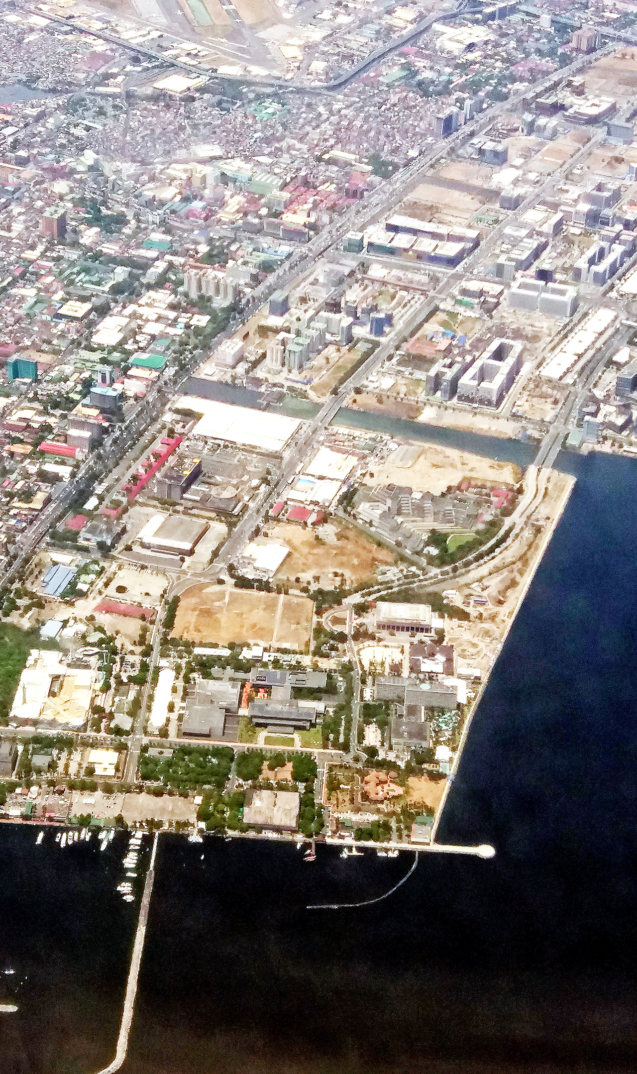
Bayside development, along Roxas Boulevard and within the reclamation districts from the CCP Complex south to Entertainment City, has ramped up in the last decade. The infrastructure connections of Macapagal Avenue, the NAIA Expressway connection from the airport, and the CAVITEX to the south has also primed the area for rapid growth.
Metro Manila’s coastal corridor has not been a key focus of development until now. It is important to understand its historical context, as well as situate future growth within a framework of sustainability of the environmental as well as of economic kind.
The origins of the strategy of development through reclamation and coastal development started over a hundred years ago. The American planner Daniel Burnham was awed by the historic character of Manila, as well as the beauty of its bay, when he visited in 1904. He compared it to Naples’ 15-kilometer coast, which is a top tourist attraction to this day.

Burnham completed his master plan for Manila in 1905 incorporating a sweeping seaside boulevard and promenade that would connect central Manila with the port at Sangley. He was so enamored by the concept that he incorporated it in his 1909 plan for Chicago. This is now known as Lake Shore Drive.
Chicago’s most expensive and sought-out properties has always been along Lake Shore Drive because of the views and access to extensive seaside parkland.
Manila did not fully build the full 20-kilometer seaside boulevard but settled for roughly two kilometers from the Luneta to the Manila Yacht Club until reclamation in the 1970s extended it until Pasay City.
Roxas Boulevard was built on reclaimed land running parallel to the historic Calle Real that the Spanish used to travel to Sangley, where the Acapulco galleons were anchored. The first real estate subdivisions rose along this strip, which became the preferred residential district for American expats and the upper class until the outbreak of the Second World War.
The war left Manila in ruins. After liberation and the granting of independence in 1946, Manila experienced a flight to the suburbs. This was assisted by the fact that the capital was transferred eastward to Quezon City. The circumferential road we now know as EDSA also contributed to the evolution of the conurbation we now know as Metro Manila.
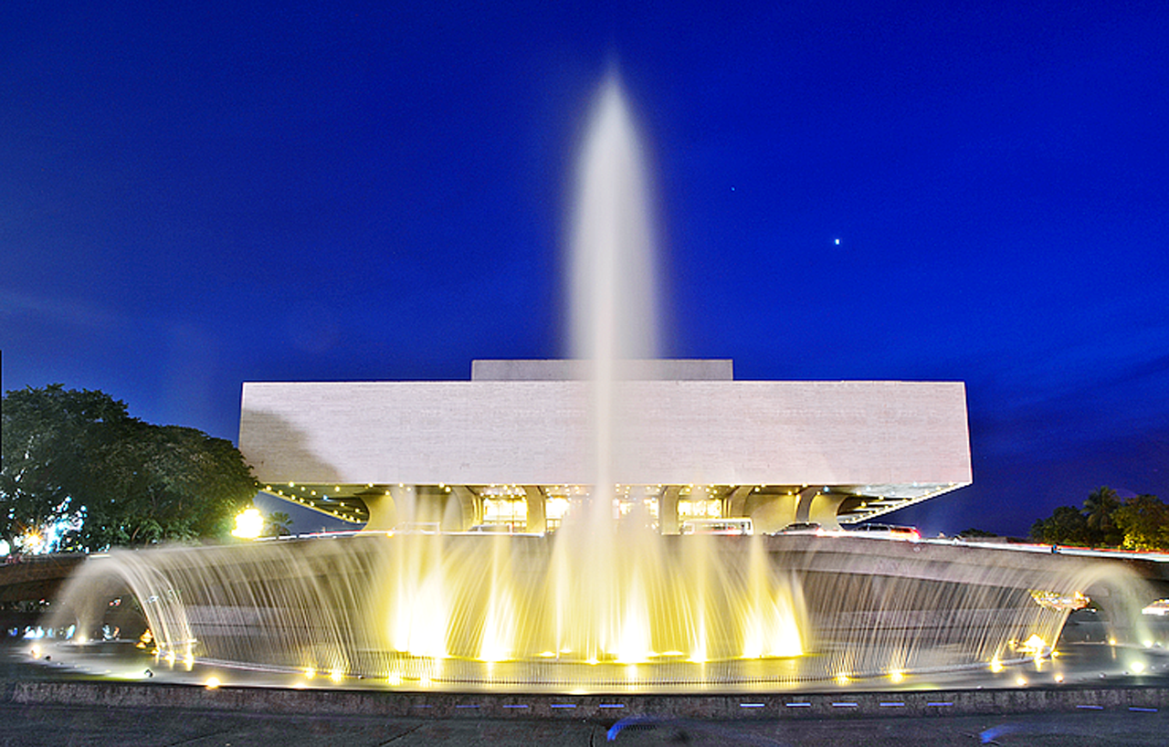
But within three decades, Metro Manila was filling up and had extended to the natural barrier that was the hills of Antipolo. Northern and Southern expansion was limited due to the limited capacities and lack of connectivity of the north and south expressways. The government was drawn to look at possibilities of expanding the metropolis westward via reclamation of a coastal corridor, a project that had already started with the building of the CCP Theater and its complex of exhibit halls, convention center and hotel.

The Manila-Cavite Coastal Road and Reclamation Project was a 1970s government initiative to consolidate more land for development. Initially this was to build a national government complex incorporating the CCP, a district for all of government’s financial institutions, and a new site for Malacañang Palace. By the end of the martial law regime, the reclamation saw only the GSIS and PNB complexes built. The impetus to create a National Government Center fizzled out.
After the People Power revolution and under the Ramos administration, a new master plan for the reclaimed area was conceived. Boulevard 2000 sought to maximize this real estate much like the strategy of BCDA with military camp conversions. This led to commercial real estate developers, among them SMDC, Federal Land and ASEANA of DM Wenceslao, creating a series of enclaves.
The completion of the Mall of Asia, one of the largest shopping complexes in the world, jumpstarted development in the area. The mall is now surrounded by several condominium complexes, BPO blocks, a large arena and soon the first IKEA in the country. Federal Land’s Metro Park nearby is following closely with condos and BPOs, while the ASEANA Business Park is now quickly filling up.
At the end of the presently reclaimed area is Entertainment City, a gaming and entertainment district under the aegis of PAGCOR. It is a PEZA-approved economic zone. With direct connections to the airport and both CAVITEX and SLEX (via the skyway), this district has been changing the landscape of the metropolis since the first complex started construction a decade ago.
Solaire Resort & Casino by Bloomberry Resorts Corporation of tycoon Enrique Razon was first to open in 2013. This was followed a year after by the City of Dreams Manila complex owned by Melco-Crown and its local partner Belle Corporation and SM Investments Corporation. The strombotic Okada Manila came on line in 2016. Under construction is the Westside City Resorts World complex owned by Travellers International Hotels Group, the Genting Group and Megaworld Corporation of Andrew Tan. More developments are planned in the district, which is made distinct from the other enclaves north of it by the planned construction of a 10-hectare park, the New Nayong Pilipino. The reincarnation of the 1970s-era landmark will lend some balance and green amenity to tourists and locals.
Manila Bay, and proposals to expand real estate development along the coast, via additional reclamation, has been the center of attention recently. The bay’s environmental rehabilitation is well underway, continuing a program that started with the drastic measures levied on Boracay last year. The Manila Bay area is, of course, over 300 times greater than Boracay’s.

The impact of additional reclamation is also under study via a NEDA initiative in collaboration with the government of the Netherlands for a “Manila Bay sustainable development master plan.” Private development companies are also conducting their own studies for more contained areas.
Urban development is pushing south of Metro Manila. With horizontal development maturing from Muntinlupa and cities in Laguna south of it, the pressure is to find new ground (literally) for development to accommodate an expanding Metro Manila population and economy.
A key factor in this region would be the decision on the relocation of the international airport. The current facility is too close to urban areas compared to other metropolitan centers region-wide and even globally. Relocation to Sangley or Bulacan, or Clark would greatly impact real estate development. The airport complex covers over 600 hectares. If relocated this would release some pressure and give options to expansive reclamation. It would also release some maximum height constraints over existing centers.
The prospects of this entire movement south are exciting as they are challenging in terms of finding a balance between environmental integrity and urban progress. Cooperation and collaboration between government and private concerns, coupled with active involvement of and consultation with all public stakeholders would be the ideal avenue to ensuring this balance. In this century we then could finally achieve a vision of functional, efficient, sustainable and beautiful cities by the bay.
